GEOL 241 Spring 2023 Photo Album
A listing of our lab meeting activities and materials - updated weeklay as we go. Please see the Syllabus and Schedule document for our anticipated shedule.
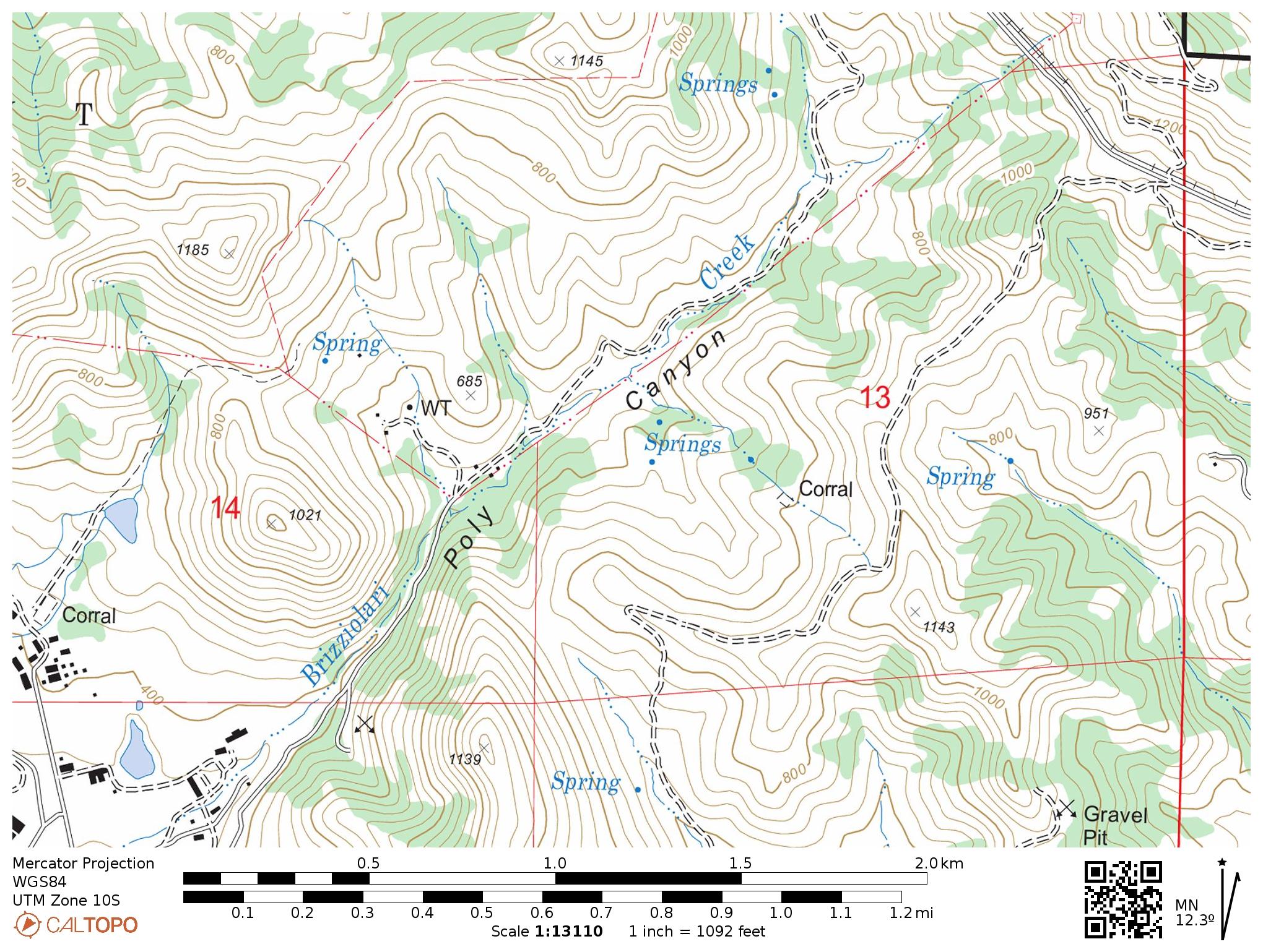
We return to Poly Canyon to look at the stratigraphic profile we started in Week 1. This time we will start at the Serenity Swing and work our way down.
Please refer to the same maps that are linked in Week 1.
Here is a copy of the topographic map you used in the field.
Please complete the take-home assignement linked here by the end of Week 10 (Friday). Drop off at my office on the bookcase, or at the lab practical if you are done with it by then.
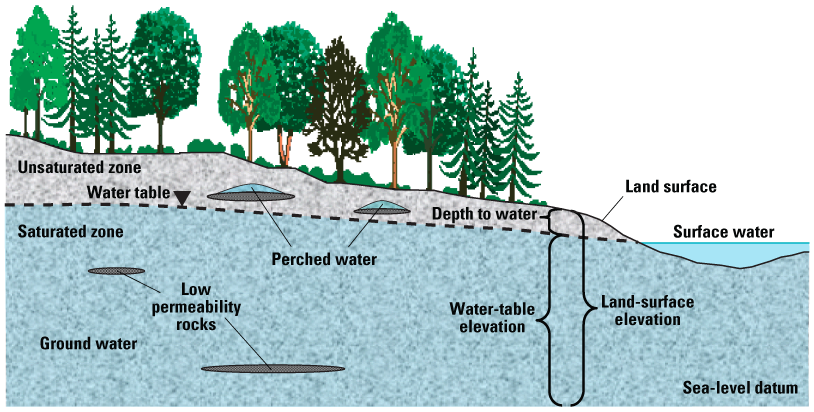
In this on-campus field lab we will think about how we can find the depth to the water table in a sediment surface unit.
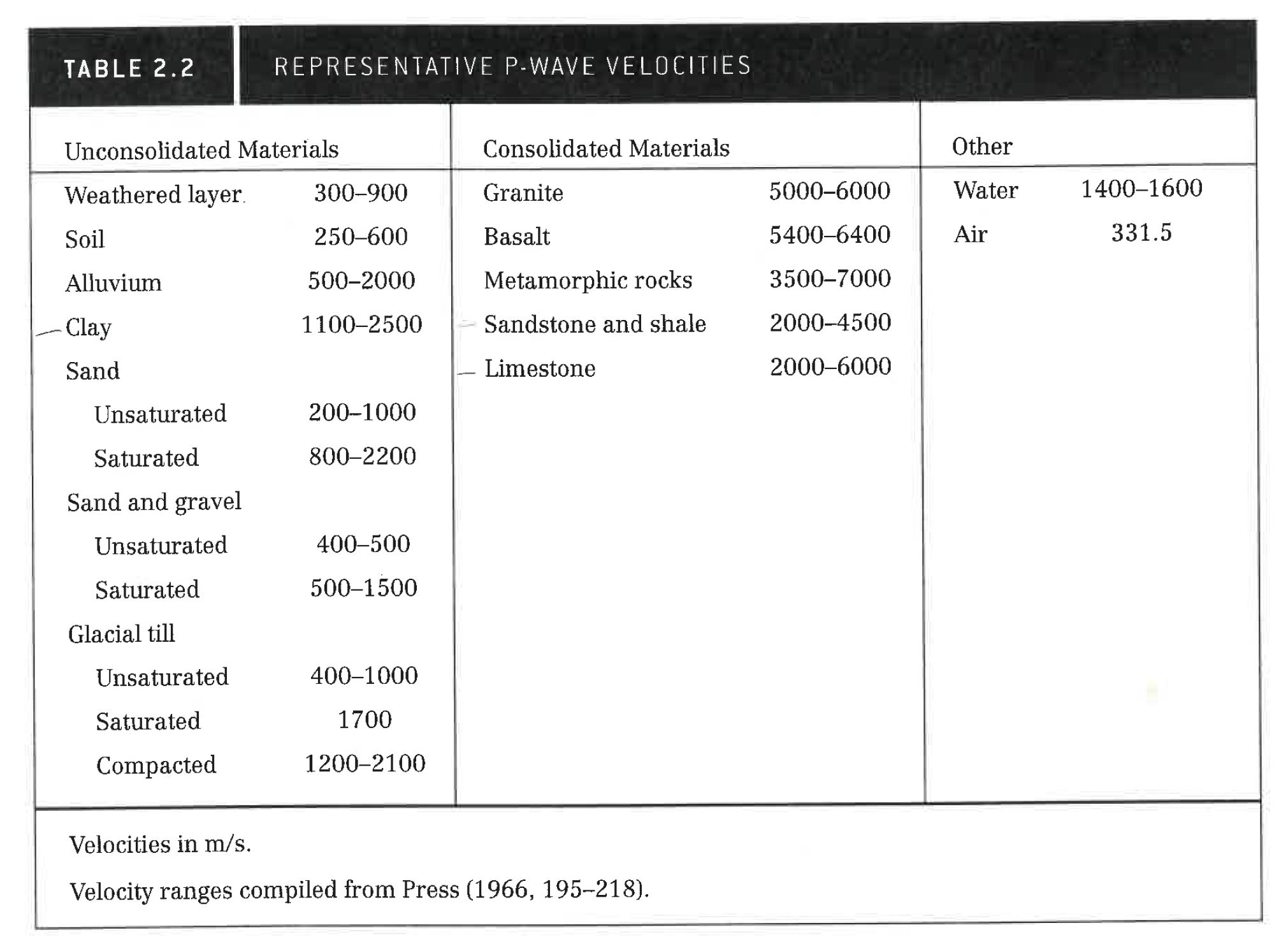
Overview of the seismic refraction method (animation) The Seismic Sprint. Remember, the evidence our waves have interacted with a layer boundary is the change in slope of our first arrival data.
Table of P-wave velocities:
Spredsheets of the field data. Right click to download Excel spreadsheets.
In this in-class lab meeting we will practice converting simple geologic maps to cross sections and deducing a plausible geologic history. We will also examine some geologic maps and cross sections that are already plotted on them.
Finally, you will do an assignment at home for the following week in which you will draw a cross section from the fairly complicated geologic map "Somewhere, Wyoming".
Materials:
In this in-class lab activity you will use the knowledge of topographic and geologic maps implicitly gained from our previous field activities to make a systematic study of topographic and geologic maps.
Link to the Lab Activity Handout
Pre-lab meeting reading resources on faults and deformation. A couple of resources are listed below:
In this field-lab activity we will identify the differences between the Monetery and Santa Margarita Formations in the Lopez Lake area, as well as measure the strike, dip, and dip direction of the bedding. In this way we will identify a geologic structure that is prominent in this region.
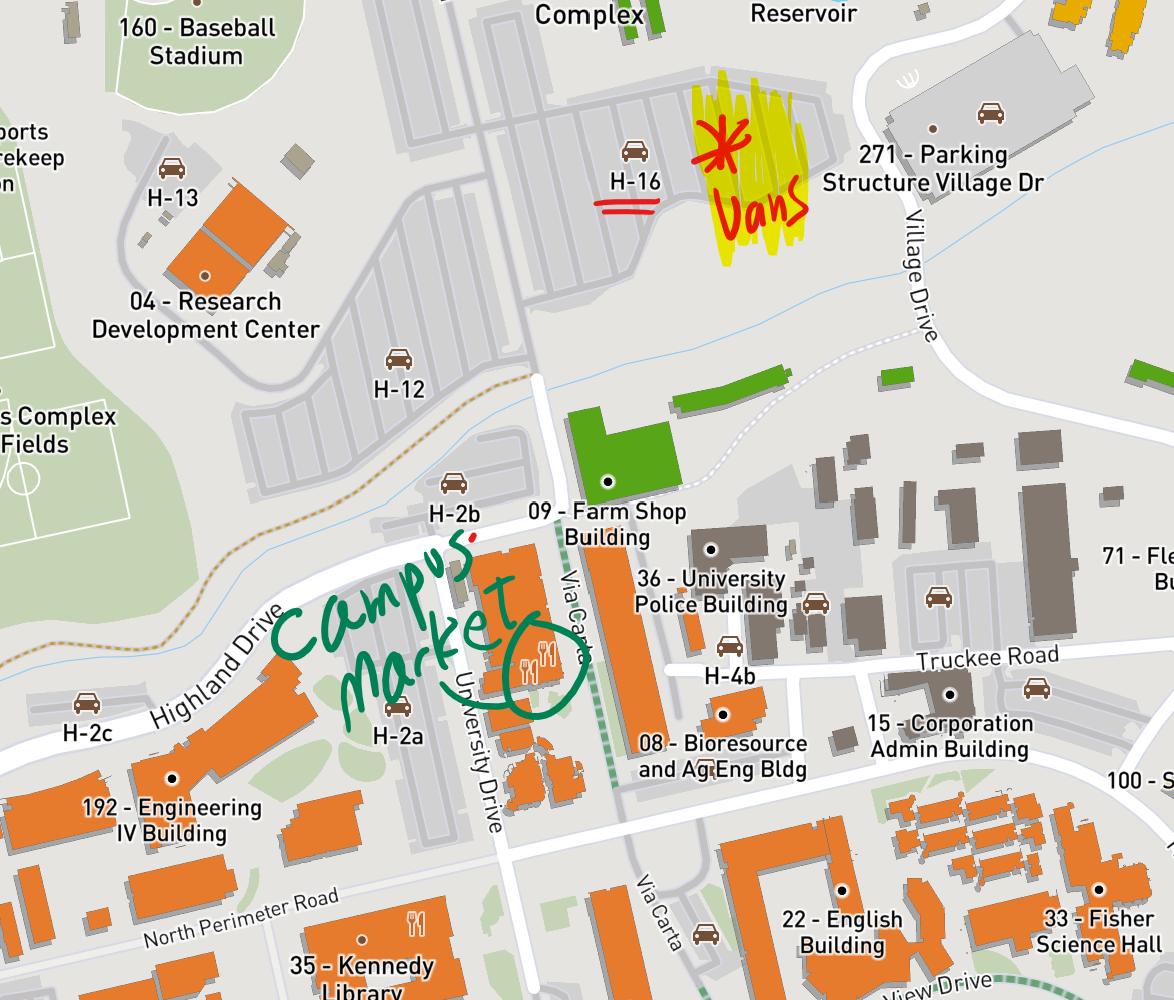
We will meet at the H16 parking lot where the vans are parked (this is where we dropped ourselves off at the end of last week's field trip):
In this meeting we get back to the field! Please see the field handouts below.
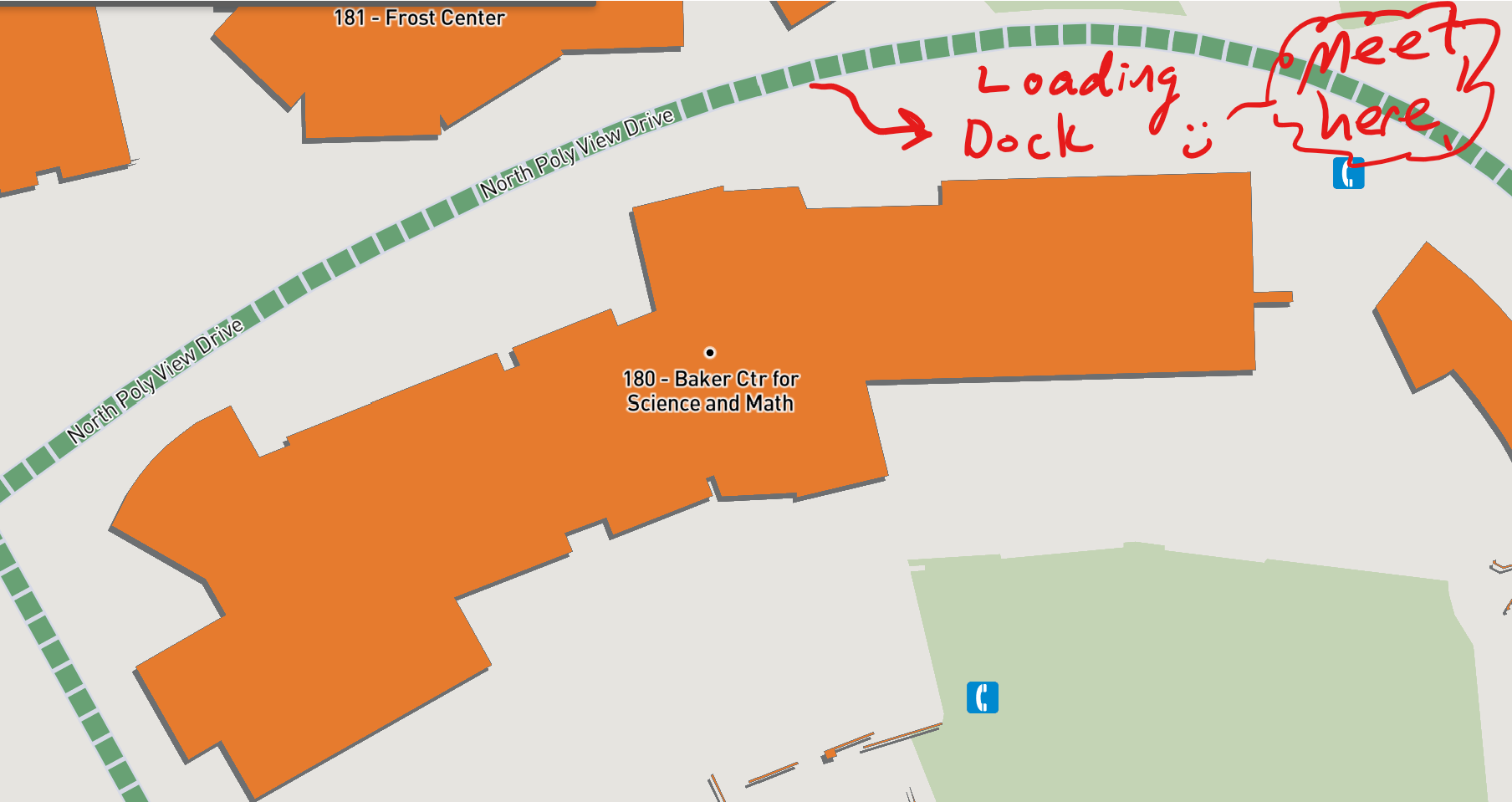
We will meet in the "loading dock" area behind our building (see image below). Some of you may have done soil science activities back there. Please be there at 8:10 a.m. sharp! - if you are running late call or text me, see syllabus online for the phone number.
In this lab activity we will examine sedimentary and metamorphic rocks in hand sample. This will complet our review of rocks and minerals and then we can head back into the field! The activities will review sedimentary structures (ripples, graded beds, crossbeds), and metamorphic index minerals and facies.
Lab Activity HandoutsHere are some resources to help you review:
The purpose of this field activity is to get acquainted with using geologic and topographic maps in the field to understand the rock units (especially the stratigraphy in this location), terrain, and understand how to locate yourself.
It will be a fun way to get acquainted with rocks in their natural habitat before the next two classroom lab activities where you will examine rocks and minerals in hand sample.
Here are links to copies of the handouts I will provide in the field. Bring a pencil and eraser, and if possible, a clipboard will be convenient.
⚠ Take home assignment:Due at the next lab meeting → Drawing a topographic profile.
Below are some links to help you draw topographic profiles.