Metamorphic Rocks & Processes
Back to the GEOL 102 Homepage
Metamorphic Rocks & ProcessesOverviewSummary of some key ideasMetamorphic ProcessesPressure and TemperatureGeothermal gradientMetamorphic grade and two "P-T paths"Textural Images of Metamorphic RocksSlate-Phyllite-Schist-Gneiss ImagesHow do metamorphic rocks become exposed at the surface?ShieldsA Lingering QuestionProtolith of Blueschist?Bottom LineExtrasA Summative ImageSlide SetsMetamorphic Rocks in The Wild
Overview
A simple question to ask about plate tectonics is when did it start? This may not sound like it has much to do with the topic of metamorphic rocks at first glance.
The earth is thought to be about 4.6 billion years old (based on the isotopic age-dating - a future chapter - of the rock record), but plate tectonics could not have been present from the start, as the earth would have been largely molten for a time after accretion.
To this end, please read the following article: Age of blueschist does not indicate the origin of plate tectonics. Or, direct pdf link.
The premise is simple: since blueschist is a metamorphic rock formed in subduction zone, and since subduction zones are an essential aspect and signature of plate tectonics - then, perhaps, the age of the oldest blueschist rocks would be an estimate of when subduction zones began, and hence when plate tectonics began.
However, as you can see from the title of the article this idea is thought to be false. Why?
Please read the article and be prepared to formulate a written, concise, and complete description as to why this is thought to be false (at least by the research shown in this article).
Another much different instance in which a metamorphic process appears is in this article about craters (see PDF here if link is behind a paywall or signup wall).
Summary of some key ideas
Metamorphic Processes
Metamorphic processes can change the:
Texture
Mineralogy
Chemical composition
of pre-existing rocks.
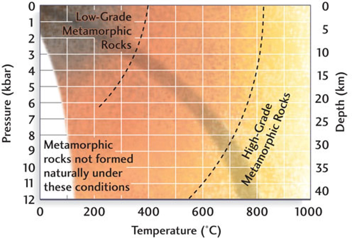
Pressure and Temperature
What is the P &T range of metamorphism? Of course, all the figure below says is that more pressure and/or temperature means more metamorphism. But it's still good information to know the range -- it isn't limitless after all. What is the range of depth and temperature in which metamorphism takes place?
Geothermal gradient
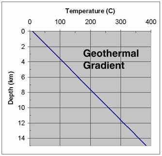
So a rule of thumb is that temperature increases something like 30 deg-Celsius/kilometer in the earth (variations exist of course). How does this look within the earth? Below are some contours of constant temperature lines shown at different depths (or, correspondingly depth) in the crust and upper mantle. Note that the deep continental crust is well over 500 degrees Celsius.
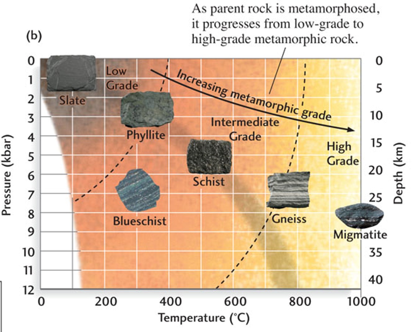
Metamorphic grade and two "P-T paths"
A "P-T" path is simply a curve in the plot where P, Pressure, is the vertical axis, and T, Temperature, is the horizontal axis (of course this is arbitrary, the axes could be reversed, but this is the conventional way to plot it).
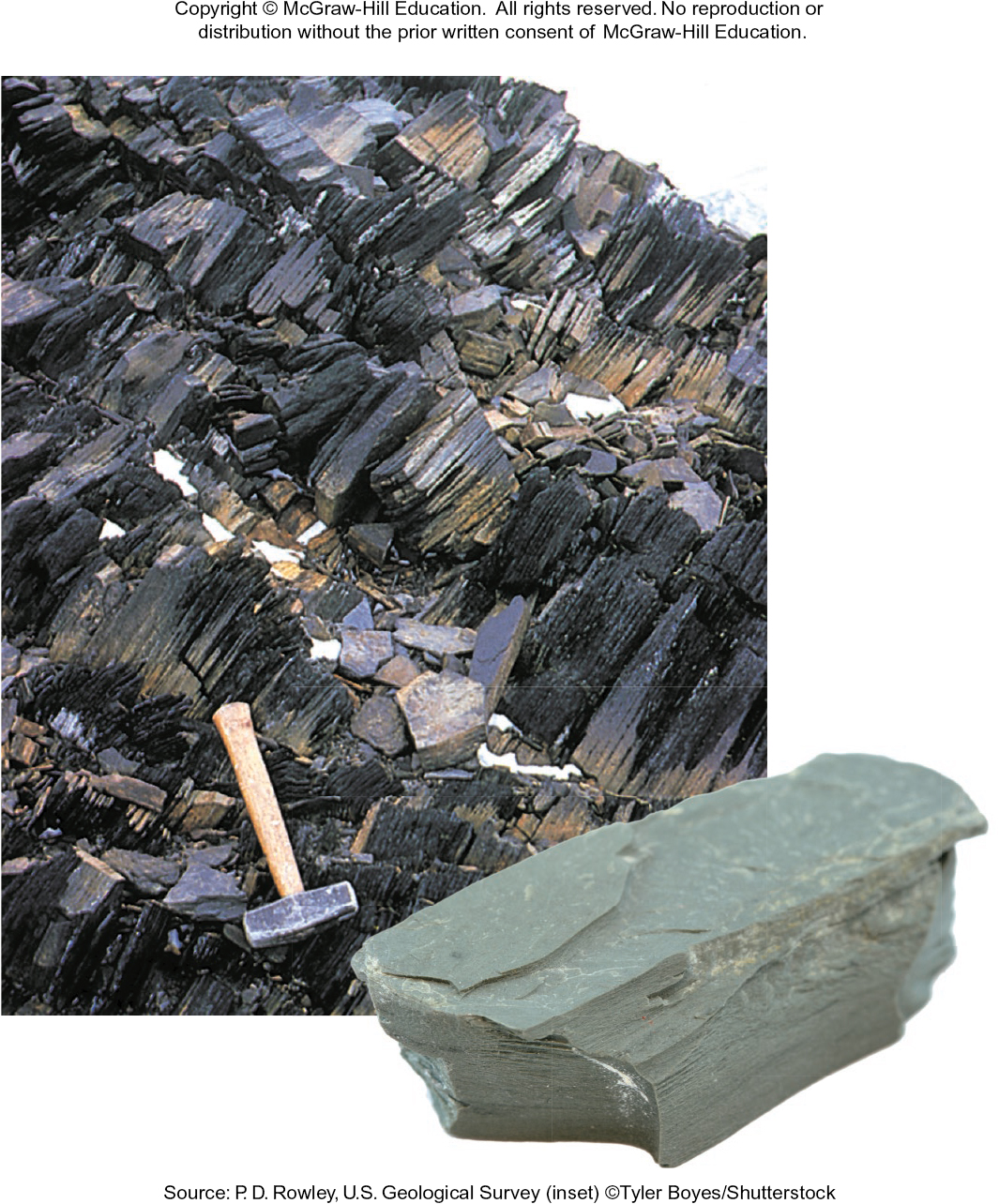
Imagine a parent rock (the pre-existing rock, or the protolith) like shale. One P-T path goes approximately diagonally from the top left of the chart, following the *slate -> phyllite -> schist -> gneiss sequence. So starting with the parent rock of shale (remember, that's a sedimentary rock) you could generate that sequence of increasing high grade metamorphic rocks. The other path goes much more steeply down the pressure axis, and much less across the temperature axis (through the rock labeled blueschist:
Textural Images of Metamorphic Rocks
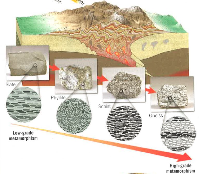
Slate-Phyllite-Schist-Gneiss Images
The images below show the "texture" or visual characteristics of the slate-phyllite-schist-gneiss sequence of metamorphic rocks.
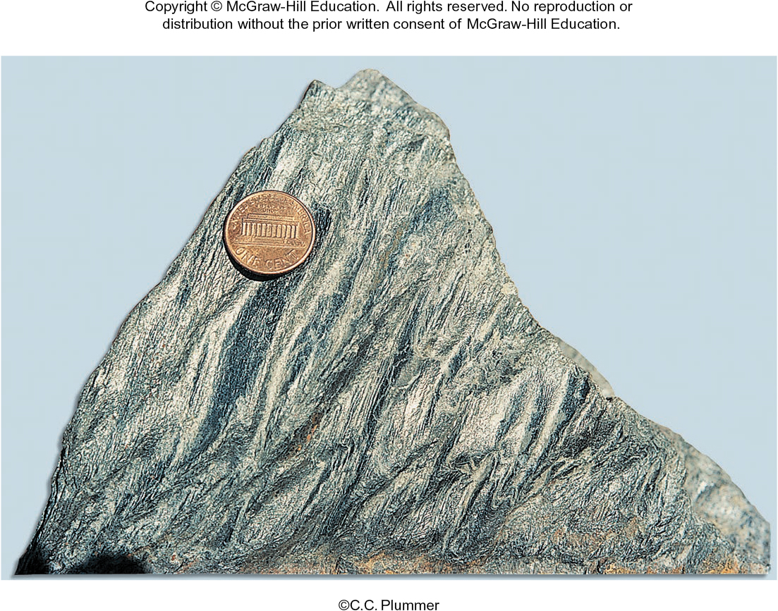
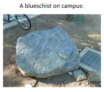
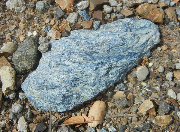
**Here we see an example of blueschist on our own campus (by Building 10). If you look around campus you will see other examples (back side of the Performing Arts Center not far off the bike path):
Where do each of these above P-T paths occur (i.e. the one that generates slate-phyllite-schist-gneiss, vs. the one that generates blueschist)? If we could understand that, then: metamorphic rocks would be very useful in telling us about the tectonic history of a region!
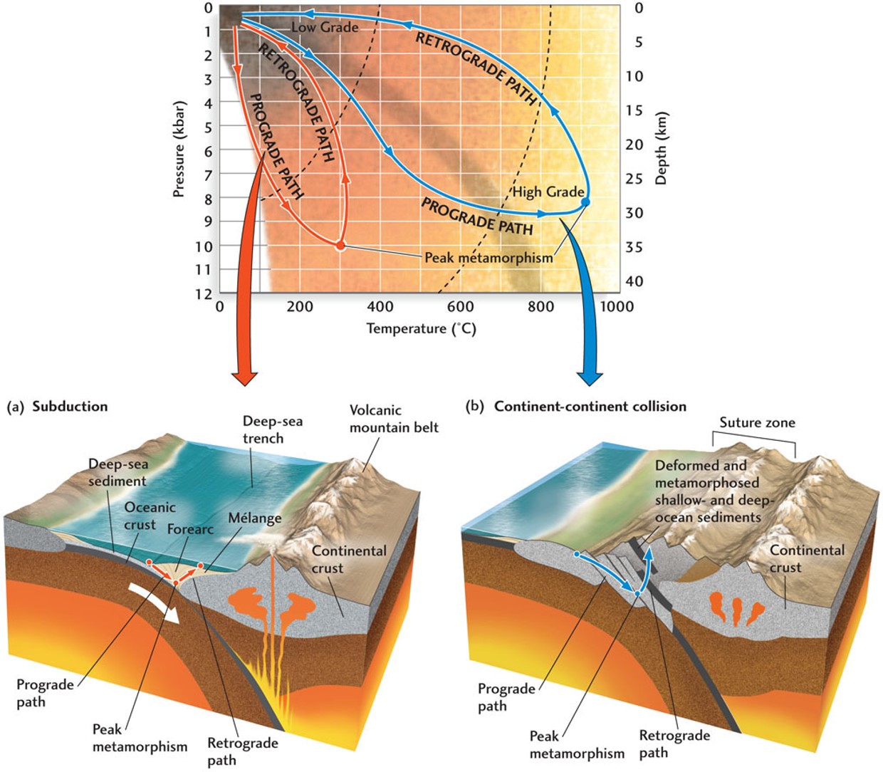
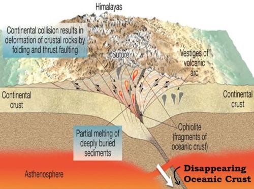
Note the two distinct tectonic settings: subduction zone and continental-continental collisions. In the subduction zone setting, a representative metamorphic rock is blueschist, while in the continental collision setting we get the sequence of slate, phyllite, schist, and gneiss ("nice"). Here's more detail on each environment:
Closing oceanic basin, leading to
and once more:
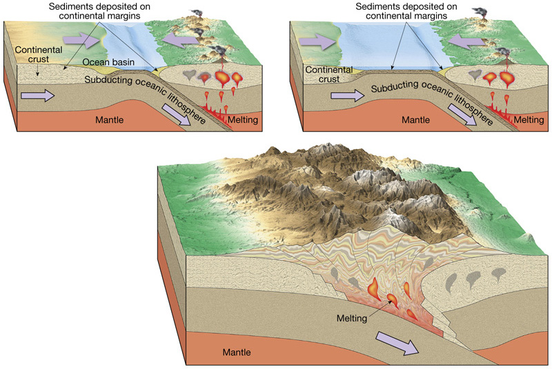
Now for subduction zones:
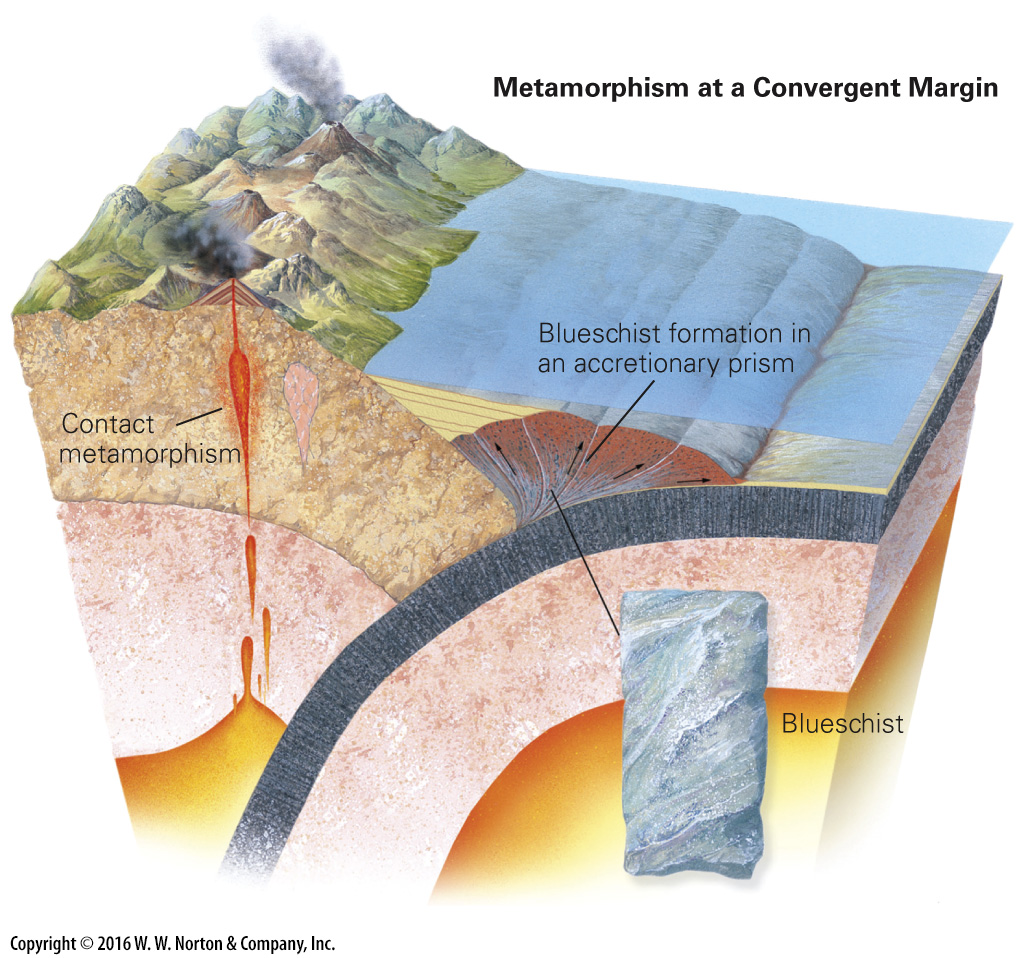
Here is an excellent blog post about subduction zone rocks
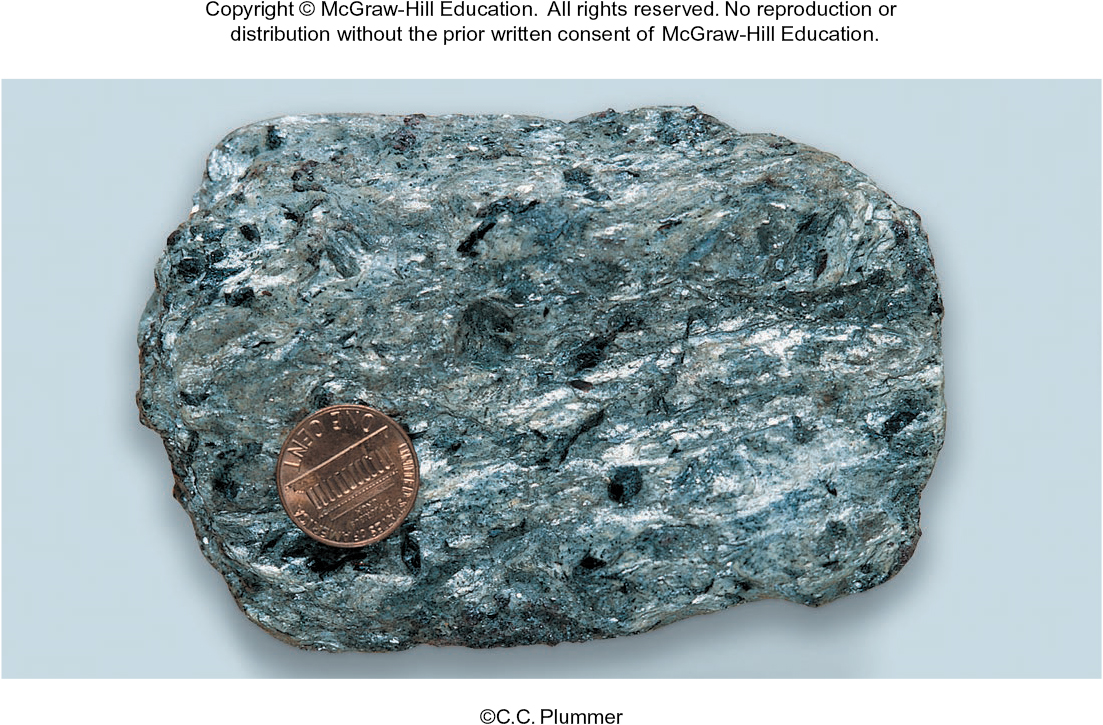
We can think of blueschist as a "representative" rock that is formed in a subduction zone (of course, there are more). A blueschist on campus:
Another blueschist example:
How do metamorphic rocks become exposed at the surface?
Shields
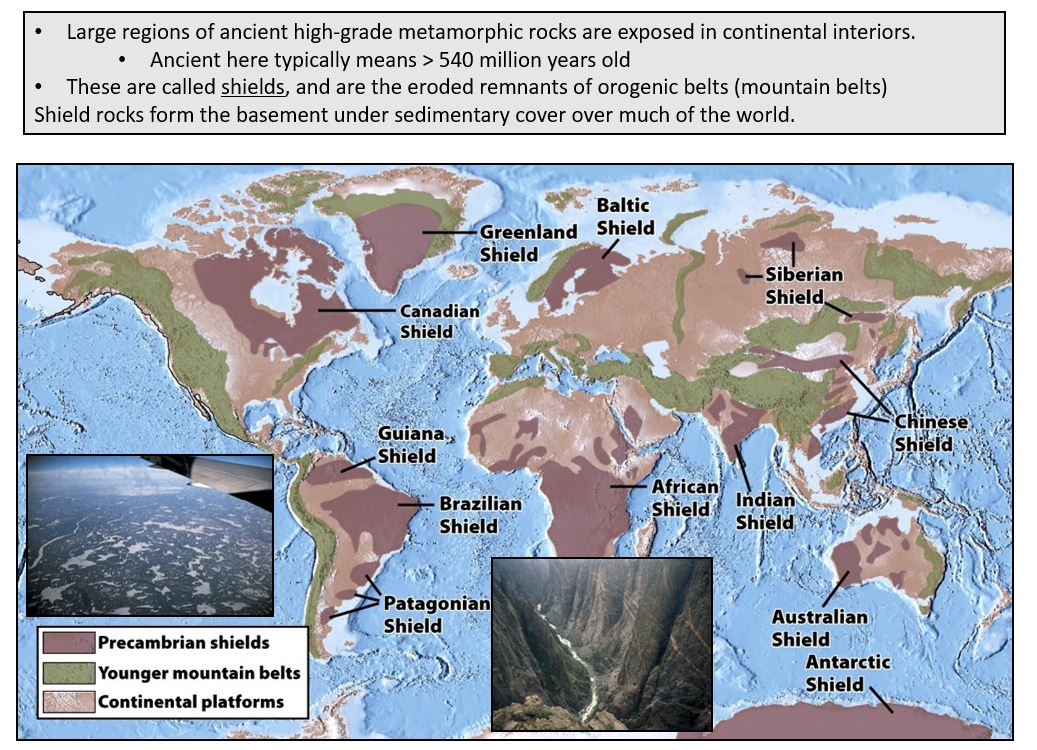
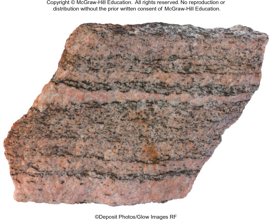
The Canadian Shield - exposed high-grade metamorphic rocks (like schist, gneiss) at the surface:
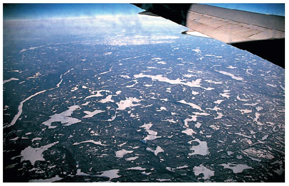
So we know there must have been a large mountain range (a former continental-continental collisional tectonic environment).
Where did the mountain range "go"?
And how did the deep high-grade metamorphic rocks become exposed?
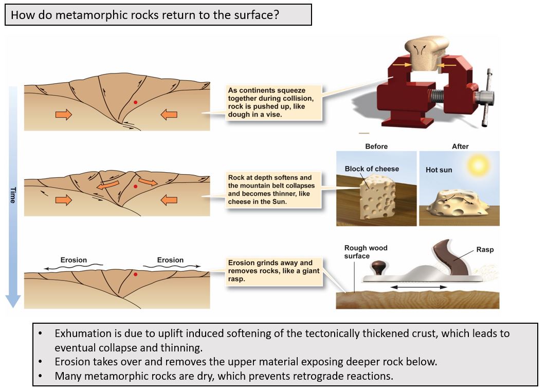
A Lingering Question
If protoliths** forms a high-grade metamorphic rock at ~ 35 km depth, once it becomes exposed (or, as it starts its way back up), why doesn't the metamorphism "back-react" to turn it back into the original rock (for example, shale?).
** (parent rocks that transform, or "metamorphose" into metamorphic rocks, e.g. shale in the above)
Protolith of Blueschist?
We've seen that shale can be a protolith for the slate-phyllite-schist-gneiss sequence of increasing metamorphic grade rocks.
In your chapter reading, what is the typical protolith of blueschist?
Bottom Line
Metamorphic rocks can tell us about the tectonic history of a region, allowing geologist to be "historians".
Extras
Examples of metamorphic rock in societal hazards:
Heath Canyon Landslide in Wrightwood, CA. Can you think of why schist would be prone to this type of failure. Think about the fact that schist has foliation planes.
A Summative Image
In the figure below we see a cross section of geologic provinces where we would expect to find examples of the different types of rocks we have discussed:
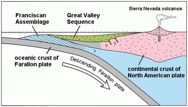
Figure attribution
The Franciscan assemblage consists of metamorphic rocks, including the blueschist rock we have discussed. The Great Valley Sequence consists of sedimentary rocks such as sandstones, turbidites, shales, and mudstones. Finally, we see a volcanic arc (in pink), and the associated intrusive plutonic rocks (e.g. diorite, granite) as well as the extrusive rocks of the volcanic arc.
In the above figure, this generic cross section is labeled with what the local names of the rocks are in the central coast area, from > 30 million years ago when there was a subduction zone off this part of western North America. You can see how the Sierra Nevada mountains were formed, although they are no longer a volcanic arc since the subduction zone is gone.
Slide Sets
The slide sets are broken up into several smaller pieces:
1. Metamorphic Samples
2. Metamorphic Rocks
3. Indicator Minerals
4. Exhumation of Metamorphic Rocks
Metamorphic Rocks in The Wild